
Ballwin Postal Coverage
Ballwin’s official Ward and Street Search places municipal street ranges in three ZIPs: 63011, 63021, and 63017. The city source is a street and house-number reference based on 2000 Census data, not a delivery map or resident roll. It provides a good municipal check because its rows combine ward, street name and number range, ZIP, and aldermen. USPS still determines the postal ZIP for a complete delivery address. The county parcel layer supplies another comparison point through its `PROP_ZIP` attribute.
| ZIP | Areas Covered | Post Office | Notes |
|---|---|---|---|
| 63011 | Central, north, and east Ballwin examples, including many Clayton Road, Kehrs Mill Road, and Manchester Road ranges | Ballwin Main Post Office, 15455 Manchester Rd | Main local facility; not a full city-boundary map |
| 63021 | South, east, and southeast examples, including Arbor Trails, Ballwin Commons, Claymont, Castle, and Westglen areas | Specific serving station not located in the research | Postal service geography and municipal limits differ |
| 63017 | Western and northwestern pockets, including Capitol Landing, Westpar, and Wetherburn examples | Specific serving station not located in the research | Postal city can read Chesterfield or Town and Country |
The directory cannot turn these examples into a boundary line. Use the city range table for a municipal address check, USPS for delivery standardization, and GIS for parcel geography.
Ballwin 63011 Delivery Area
ZIP 63011 appears throughout the central, northern, and eastern parts of Ballwin’s official street list. Examples include Agean Way, Algonquin, Andante, Ballpark, Baxter, many Clayton Road segments, Kehrs Mill Road, and the north odd-numbered Manchester Road range from 14637 through 15121. The documented post office is Ballwin Main Post Office at 15455 Manchester Road, Ballwin, Missouri 63011-9998. The research records its phone as 636-227-5783 and its listed hours as Monday through Friday 8:30 a.m. to 7 p.m., Saturday 8:30 a.m. to 3 p.m., and closed Sunday.
The Ballwin Ward and Street Search supplies the city’s range and ward context. A range match is useful for comparison, but it does not establish a postal result for a particular unit or a current occupant.
Ballwin 63021 Delivery Area
ZIP 63021 covers Ballwin street examples in the city’s south, east, and southeast areas. The research identifies Arbor Crest, Arbor Trails, Ballwin Commons, and Claymont, Castle, and Westglen subdivision streets among the local examples. Those names are useful address-research anchors because a subdivision, plat, or parcel locator can stay meaningful even when a postal label differs from a city label. A title or deed search should preserve the subdivision and legal description rather than relying on ZIP alone.
No specific post office or station assignment for every 63021 Ballwin address was located in the official sources. Verify a full address through USPS before describing the delivery ZIP. The absence of a captured station is a source gap, not evidence that the ZIP lacks service.
Ballwin 63017 Postal Names
ZIP 63017 is Ballwin’s clearest postal-city mismatch. The official street list includes Ballwin addresses on Capitol Landing Drive, Chowning Court, Cypress Trace Drive and Court, Downall Green Drive, Eagles Chase, Glen and Landing courts, Fairway Lake Court, Fairwood Forest Court, Westpar Drive, and Wetherburn Road. Yet a postal result for a 63017 address may use Chesterfield or Town and Country as its city name. That postal wording does not erase the Ballwin municipal address shown by the city source.
City boundary check. A postal ZIP is a delivery geography, not a municipal boundary. Do not reject a Ballwin address because its 63017 postal city is Chesterfield or Town and Country, and do not assume every 63021 address is inside Ballwin.
County GIS municipality fields and the city street-range result are better sources for the city question. Keep the postal city, municipality, ZIP, and street range as separate entries in a research note.
Verify a Ballwin Postal Address
Use the same full address every time. A directional, street type, apartment, or unit number can change the postal result and makes later record comparisons harder when omitted. USPS provides the delivery standardization step. The county and city sources then test whether that postal answer fits the parcel and city context. This is the reliable workflow for a postal address search because each system is answering a different question.
- Enter the complete street address, city, and Missouri into the USPS ZIP Lookup and save the standardized result.
- Compare the returned ZIP with the Ballwin Ward and Street Search result for the street and house-number range.
- Open the county property or GIS record and retain its address, locator, `PROP_ZIP`, subdivision, and municipality labels.
- When the ZIP narrows the address, use the Ballwin street directory for the fuller address-record chain.
The USPS listing for Ballwin Main Post Office is the source for this local postal reference.
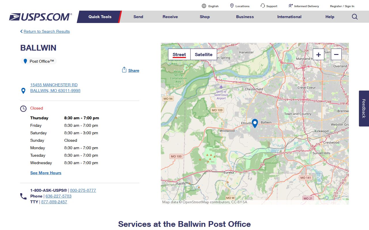
The listing confirms the 63011 facility as a local postal reference. It does not assign a station to every 63021 or 63017 address, or establish parcel ownership, residence, or a city boundary.
Ballwin Parcel Search Fields
ZIP filtering is not uniform across Ballwin’s official record channels. Devnet exposes one combined text field, not a separate ZIP search box. The county GIS service returns `PROP_ZIP` as an attribute after a parcel is located, but the exact viewer ZIP-filter control was not captured. Missouri’s voter lookup asks for a county, not a ZIP. The county voter-file output can contain ZIP information only through its separate lawful request process. Those limits matter because a portal should not be described as ZIP-searchable when its visible fields do not support it.
| Official Channel | Field or Result | ZIP Limitation |
|---|---|---|
| County Devnet | One “Property Number, Owner Name, or Address” field; property-class radios and CSV export | No separate ZIP field is visible |
| County parcel layer | `LOCATOR`, `PROP_ADD`, `PROP_ZIP`, subdivision, municipality, and parcel attributes | ZIP returns as an attribute; viewer filter labels were not captured |
| Missouri Voter Outreach | First name, last name, date of birth, last four SSN, and county | County is required; ZIP is not a search field |
| Ballwin Ward and Street Search | Ward, street name and house-number range, ZIP, and aldermen | Range reference, not a person or parcel search |
That field asymmetry is useful evidence on its own. Start with a complete address and work outward instead of assuming one ZIP filter will return every property or resident associated with an area.
Ballwin Parcel and Postal Terms
Postal and property records use similar-looking address information for different purposes. Defining the labels keeps a Ballwin postal search from becoming an unsupported residence claim. A legal description may remain stable when a street label changes, while a tax mailing address may point somewhere other than the parcel. Record the exact field name with the value.
- ZIP versus ZIP+4
- A ZIP is the basic postal area. ZIP+4 adds a delivery segment and is not a city-boundary or resident identifier.
- PO box ZIP
- A ZIP used for post-office boxes. It does not establish where a person lives or where a parcel sits.
- Carrier route
- A Postal Service delivery grouping. It is not a municipal district or a public household list.
- Situs address
- The physical parcel address. It differs from a tax mailing address and a Recorder legal description.
Ballwin Postal Boundaries
Ballwin’s growth makes layer-by-layer checking especially important. The city incorporated in 1950 with roughly 750 residents and recorded 31,103 residents in the 2020 Census. Its planning area and subdivisions expanded over decades, while postal service areas and county parcel geography followed their own systems. A 2025 Arbor Trails boundary proposal involving ZIP 63021 and the 2022 Manchester annexation proposal show why dates should be retained when city and postal geography are compared.
No official Ballwin ZIP split or realignment year, and no per-ZIP population or registration table, was found in the research. Do not infer a boundary change from the city’s 2000-Census-based street list. Historical address work should pair the current range table with a subdivision plat, parcel polygon, or Recorder legal description.
Ballwin Address Record Gaps
Some Ballwin ZIP questions are really address-history questions. The research did not locate an official street-renumbering or street-renaming conversion map, a comprehensive E911 readdressing project, or a published statement naming the agency that assigns every parcel or E911 address. A historical directory number that fails in a modern postal lookup therefore needs more than a ZIP comparison. Start with the current city range table, preserve the original number and street spelling, and compare the subdivision plat, parcel locator, adjacent parcel, and Recorder legal description.
The city street source helps identify the current municipal range, but it is not a historical conversion tool. Ballwin Planning or Code Enforcement, or county GIS, may be able to identify the appropriate address-history record when a documented historical address does not map cleanly. School-attendance-zone searches and utility account-holder searches were not located as public address channels and should not be assumed. A ZIP result can help normalize delivery mail, yet the legal description and parcel geometry remain stronger continuity keys when a street label has changed.
Ballwin Postal Record Limits
A postal directory can organize addresses, but it cannot identify every person associated with those addresses. Parcel records identify owners and tax-mail clues, not every occupant. Voter records are subject to protected-address and use rules. GIS shows parcel geometry and attributes, not a resident-list button. Historic directories and reverse pages can reconstruct a dated household picture, but only for the year and coverage of the source.
Use the ZIP as a comparison key, then state what the underlying record actually supports. When an address is unclear, retain the conflicting postal and municipal labels rather than forcing a single answer.
Note: Exact station assignments for ZIPs 63017 and 63021 were not located in the research and should be verified for a specific delivery address.