
Ballwin Neighbor Block Records
Public block research in Ballwin is parcel and record based. The county GIS layer shows physical adjacency and parcel attributes. The city street list gives wards, house-number ranges, ZIPs, and a maintenance note. County election records have a different access route, and historical directories describe a past household rather than a current one. Association sites are helpful for maps, indentures, notices, and contact paths, but the research did not locate a public member directory for the Ballwin associations reviewed.
| Source | What It Shows About a Block | Access |
|---|---|---|
| County GIS parcel polygons | Boundaries, address, ZIP, subdivision, municipality, land use, and district attributes | Free viewer or REST layer; no household-list button |
| Ballwin Ward and Street Search | House-number range, ward, ZIP, aldermen, and street maintenance note | Free city page; based on 2000 Census data |
| County voter list | Lawfully requested registration fields, precinct, district, and possible history fields | Separate Board of Elections form, fee, and restrictions |
| County directories and reverse pages | Dated address-to-occupant snapshots and nearby street entries | St. Louis County Library print, microfilm, and Digital Archives routes |
| Subdivision and HOA materials | Public maps, indentures, trustee or board contact, notices, and documents | Association sites or city trustee registration; no roster claim |
| Recorder and Assessor records | Parcel owners, mailing and situs distinction, deeds, plats, and liens | County portals and copy request routes; owner is not occupant |
These sources describe different relationships. A parcel owner may receive tax mail elsewhere. A historical directory name may be an earlier household. A voter record, when lawfully accessed, is a registration record. Treating all three as a current resident list would lose the actual limits of the records.
Defining Ballwin Neighbor Edges
Before mapping a Ballwin block, write down what “neighbor” means for the task. It can mean a parcel that shares an edge with the subject, a parcel directly across the street, the same house-number run, the same subdivision, or the same precinct. These choices are not interchangeable. A corner parcel can meet a different legal block, and a common drive or private street can make the next visible number unrelated to the subject parcel.
County GIS can also reveal a park, church, stormwater tract, common area, or commercial parcel between two homes. That explains a gap without implying a household. A parcel touching the subject can also sit across a ZIP or municipal boundary. Store the geometric rule used, the parcel locator, the source date, and any uncertainty in the research note.
Note: “Next door” is a map relationship, not a statement about who occupies a parcel or how households know one another.
Mapping Ballwin Neighbor Parcels
The St. Louis County parcel layer supports a careful GIS-to-record workflow. Locate the subject address or locator, select its polygon, and inspect immediately touching parcels or parcels across the street. The layer can return a property address, ZIP, locator, subdivision, municipality, land-use, value, and district attributes. Its REST service supports standard queries and returns parcel geometry, but the research did not capture viewer controls for a buffer, radius, measure, or print tool. It also does not provide a button that generates a resident list.
- Locate the Ballwin address or parcel in the county GIS viewer and save the subject locator, address, ZIP, subdivision, and municipality labels.
- Click every polygon sharing a boundary or immediately across the street, using the same geometric definition for each.
- Compare neighboring locators with Devnet or Assessor results, keeping owner, situs, tax-mail, and assessment fields separate.
- Use the Recorder only when a deed, plat, or legal description is needed to explain a parcel relationship or boundary.
The St. Louis County Assessor portal is an official companion to the parcel layer and can help compare a parcel to a current assessment record. The research did not capture the legacy IAS field order or viewer controls, so an unverified control should not be described as a block-search feature.
Ballwin Neighbor Street Context
The city’s Ward and Street Search adds context that the county parcel geometry does not provide. Its result table contains Ward, Street Name with house-number range, ZIP Code, and Aldermen. The source also marks private, state-maintained, and county-maintained streets. Use it to learn how Ballwin describes a range, then compare that range with the actual parcel polygons. The table is based on 2000 Census data, so it should not be treated as a real-time map or a current household record.
On a block with a confusing sequence, record the range, ZIP, ward, and street-maintenance notation before drawing a conclusion. Those labels can explain why an address appears under a different postal city or why a street edge is controlled by another public agency. They do not identify an occupant.
Ballwin Neighbor Voter Limits
Missouri’s public voter match is not a block browse. It requires first name, last name, full date of birth, last four Social Security number digits, and county. For broader lawful research, the St. Louis County Board of Elections has a distinct list-request form. County-wide lists cost $40, while a district or municipal list costs $20, with lower amounts for an additional list in the same order. The form has filters for election or district categories and active status is the normal setting.
RSMo §§115.157 and 115.158 limit public voter information and restrict non-commercial list use. Precinct registers may be publicly inspected at reasonable times under RSMo §115.163, but protected addresses remain protected. Safe at Home participants use a substitute address and the election authority does not receive their actual address. Do not scrape the match tool or try to infer a protected location from a voter file.
Ballwin Neighborhood Associations
Association records can add a physical and civic layer to a Ballwin block search. They are most useful for a subdivision map, indentures, restrictions, trustee or board contact, and meeting information. They do not establish that every household on a street belongs to an association. The city’s subdivision page has a trustee-registration form, but its registration is a contact channel rather than public proof of membership, and the research did not locate its publication policy.
| Association | Public Record Path | Known Limit |
|---|---|---|
| Claymont Homeowners Association | Public map, Articles dated July 12, 1973, original and revised bylaws, financial reports, newsletters, restrictions, and contact path | About 310 acres and 665 homes since 1960; no public member directory located |
| Heritage Residents HOA | Manager, board, committees, and meetings for a Ballwin 63011 association | No public member directory located |
| Winding Trails HOA | Indentures, documents, and financial resources | No public household directory located |
| Red Oak Plantation Drive HOA | Neighborhood indentures and trustee contact path | No public member directory located |
Claymont’s scale and its Ballwin connection since 1960 make its public subdivision materials especially useful for relating a parcel to a named community. They remain documents about the association and land, not a roster of residents.
Ballwin Neighbor HOA Documents
HOA papers can be more reliable than a casual neighborhood list because they identify the land and governing documents. A subdivision map can be compared to a GIS parcel polygon. Indentures or restrictions can point to a plat or lot and block. A board or trustee contact can identify the appropriate public record path. None of those documents proves every occupant of a parcel, and the associations reviewed do not publish a verified member directory.
Claymont’s administrative information illustrates the sort of public association material available for a documented Ballwin subdivision.
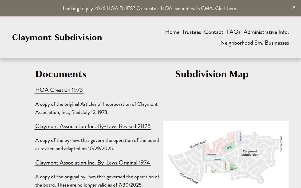
Use a public map or indenture to understand a block’s subdivision context, then verify a parcel locator through the county sources. That keeps an association document from being misread as household evidence.
Historical Ballwin Neighbor Blocks
Historical nearby households are reconstructed from dated records, not guessed from a modern map. Take the current parcel’s subdivision, lot, or street context to St. Louis County directories, reverse pages, newspaper indexes, and deeds. The county directory guide spans 1893 through 1979, with cataloged surviving runs from 1903 through 1979. A reverse-directory marker appears in the back of the 1922 city directory, though the exact Ballwin reverse run was not located. Read adjacent entries and retain the title, year, page, street spelling, and nearby names.
Ballwin’s incorporation in 1950 means earlier entries may use county, postal-place, or subdivision descriptions. The historical conclusion should stay tied to the date of the directory, census, deed, or newspaper record. A current parcel map can offer a bridge, but the bridge should be marked uncertain if the legal description and old address do not align.
Ballwin Neighbor Privacy Limits
Official records and commercial neighbor-search tools are different categories, but neither is a complete account of a block. Official county and city sources state the record, date, and field that can be checked with a custodian. Commercial tools may combine brokered, marketing, public, and user-supplied data. Their entries can be stale, duplicated, or assigned to the wrong same-name person. Association membership, renter status, household composition, utility customers, delivery recipients, and protected addresses remain outside ordinary public block lookup.
| Source Category | Useful For | Critical Limit |
|---|---|---|
| Official parcel, deed, and city records | Checking a dated parcel, legal transfer, street range, or municipal attribute | Owner or record party does not prove present occupancy |
| Official election and library channels | Lawful registration access or a dated historical household clue | Protected records, request rules, coverage gaps, and source dates apply |
| Commercial neighbor-search category | Possible starting names or addresses to verify independently | Data can be stale, duplicated, or mismatched and should not replace source-level verification |
Lawful use. Use Ballwin neighbor research for personal, civic, property, or historical questions and respect every source limit. Do not use addresses, records, or association information to surveil, harass, threaten, or intimidate anyone. Protected-address rules and Missouri stalking law still apply.